bio.wikisort.org - Zoo
Cerro Pan de Azúcar (Sugar Loaf Hill) is among the top 10 highest points of Uruguay, with an altitude of 423 metres (1,387.8 ft).
| Cerro Pan de Azúcar | |
|---|---|
 The hill viewed from a road | |
| Highest point | |
| Elevation | 423 m (1,388 ft) |
| Coordinates | 34°48′33″S 55°15′31″W |
| Naming | |
| English translation | Sugar Loaf Hill |
| Language of name | from Spanish |
| Pronunciation | Spanish: [ˈsero ˈpan de aˈsukaɾ] |
| Geography | |
 Cerro Pan de Azúcar Uruguay | |
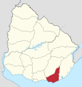
| Location | Piriápolis, Maldonado Department, Uruguay |
| Parent range | Cuchilla Grande |
| Geology | |
| Age of rock | Precambrian |
| Mountain type | Hill (granite, gneiss) |
| Climbing | |
| Easiest route | Hike |
Location and features
It is located southwest of Maldonado Department, in the municipality of Piriápolis, in a range of hills named Cuchilla Grande.
At the eastern feet of the hill and partly on its side, is the Reserva de Flora y Fauna del Pan de Azúcar, a nature reserve and zoo.[1] On its summit, there is a cross made of cement, with a height of 35 metres (114.8 feet), visible from a wide distance. The cross is visitable inside with a spiral staircase leading to the horizontal part of the cross, which offers view of the area through small openings.
History
In 1890 Don Francisco Piria, founder of the resort of Piriápolis, had bought a big stretch of land including the Cerro Pan de Azúcar and stretching all the way to the beach. The hill was rich in granite and by his decision one of its slopes became a quarry which provided solid granite rocks for the construction of the seaside resort, and which gave work to more than 500 workers.
In 1933 the famous sculptor José Luis Zorrilla de San Martín together with father Engels Walters constructed a 35-metre cross on its top. In 1980 a nature conservation and breeding centre for animals threatened by extinction was founded on its east side.
Images


See also
- Cerro Catedral
- Cerro de las Ánimas
- Geography of Uruguay
References
External links
- (in Spanish) Municipio de Maldonado
- (in Spanish) Cerro Pan de Azucar - Eco-Park
Capital: | ||
| Municipalities |
|  |
| Towns and villages |
| |
| Sights |
| |
Zoos of Uruguay | |
|---|---|
| Zoos |
|
This article about a place in Maldonado Department is a stub. You can help Wikipedia by expanding it. |
На других языках
[de] Cerro Pan de Azúcar
Der Cerro Pan de Azúcar (Deutsch: Zuckerhut) ist ein Berg in Uruguay.- [en] Cerro Pan de Azúcar
[es] Cerro Pan de Azúcar (Uruguay)
El cerro Pan de Azúcar es una elevación ubicada en el departamento de Maldonado, Uruguay. Con sus 389 msnm, se ubica entre los cerros más altos del país.Другой контент может иметь иную лицензию. Перед использованием материалов сайта WikiSort.org внимательно изучите правила лицензирования конкретных элементов наполнения сайта.
WikiSort.org - проект по пересортировке и дополнению контента Википедии